The Tour of Mont Blanc (TMB): Planning
Planning a Successful Trek
August 23, 2020
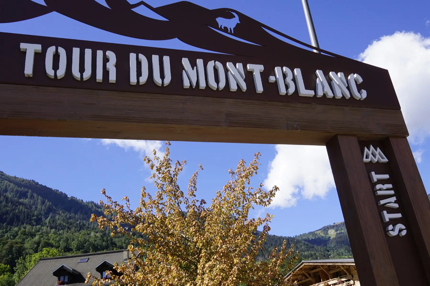
Table of Contents
We decided to tackle the TMB in 11 days. It’s the first time we would be hiking for more than three consecutive days. That felt like an accessible and fun challenge.
Step 1: Plan Sections
I can warmly recommend the book Trekking the Tour of Mont-Blanc by Kev Reynolds, published by Cicerone. You can buy the paper version, digital book, and it comes with location data (GPX tracks). You can import these files and display them on your favorite map app. I use Google My Maps to plan ahead and MAPS.ME on my phone, exporting the KMZ file from the former to the latter.
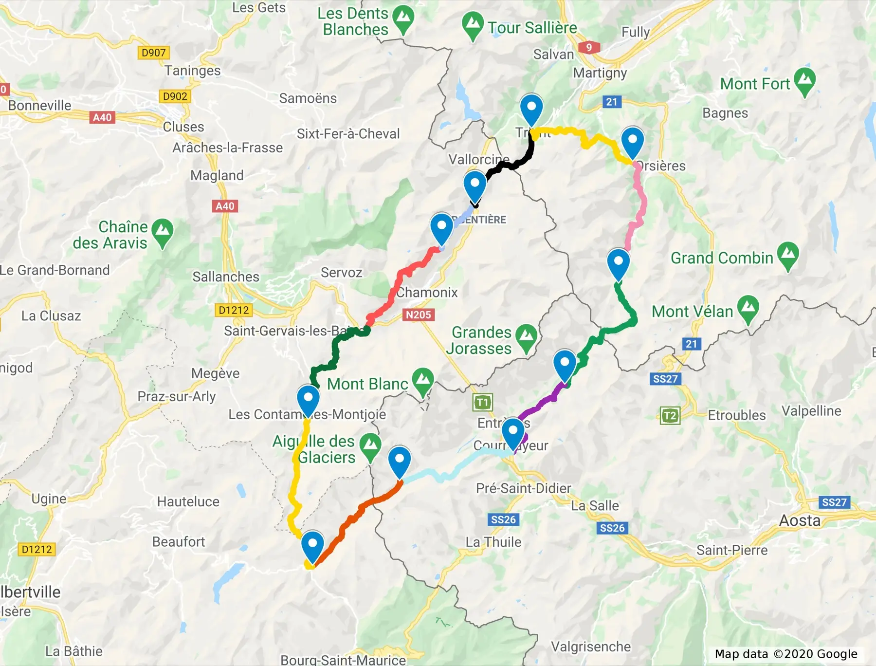
I summarized all sections, bookings details, payment details in an Airtable base. This allowed me to work collaboratively with Clotilde on the planning, plus share with our friends (for those that join us along the way).
| Day | Stage Name | Start Point | Refuges and Hotels | Walk Time | Distance | Up | Down |
|---|---|---|---|---|---|---|---|
| 1 | Les Houches – Bionnassay – Les Contamines | Les Houches (1007m) | Hotel Le Christiania | 5:30 | 17.5 km | 1010 m | 850 m |
| 2 | Les Contamines – Croix du Bonhomme – Les Chapieux | Les Contamines (1167m) | Hotel Les Chambres du Soleil | 7:30 | 19.0 km | 1360 m | 970 m |
| 3 | Les Chapieux – Col de la Seigne – Rifugio Elisabetta | Les Chapieux (1554m) | Rifugio Elisabetta | 5:00 | 14.0 km | 1100 m | 460 m |
| 4 | Rifugio Elisabetta – Courmayeur | Rifugio Elisabetta (2195m) | Hotel Berthod | 5:30 | 15.5 km | 580 m | 1550 m |
| 5 | Courmayeur – Rifugio Bonatti | Courmayeur (1226m) | Rifugio Bonatti | 4:30 | 12.0 km | 1080 m | 280 m |
| 6 | Rifugio Bonatti – Grand Col Ferret – La Fouly | Rifugio Bonatti (2025m) | Maya Joie | 6:30 | 20.0 km | 980 m | 1400 m |
| 7 | La Fouly – Champex | La Fouly (1610m) | Hôtel du Glacier | 4:30 | 15.5 km | 510 m | 650 m |
| 8 | Champex – Alp Bovine – Trient | Champex (1466m) | Auberge du Mont Blanc | 6:00 | 16.0 km | 850 m | 1040 m |
| 9 | Trient – Col de Balme – Tré-le-Champ | Trient (1279m) | Auberge de la Boerne | 5:00 | 14.0 km | 980 m | 840 m |
| 10 | Tré-le-Champ – Refuge La Flégère | Tré-le-Champ (1417m) | Refuge La Flégère | 4:00 | 8.0 km | 730 m | 270 m |
| 11 | Refuge La Flégère – Le Brévent – Les Houches | Refuge La Flégère (1875m) | 6:30 | 18.5 km | 900 m | 1770 m |
Step 2: Book Accommodations
Once we’ve agreed on the route and approximate stops, I used Google My Maps to check the vicinity of each section end point. I then cross-referenced what I found with the accommodations from the book.
I listed all the accommodations and initially called the ones that were isolated, with no alternatives around. I had heard that the TMB can be quite crowded and I feared to start booking accommodations without guarantees that the next one would be available. Once I had called and booked the riskier spots, I confirmed by email (including sending a signed COVID form when necessary). The next step was then to book the remaining nights, either by phone, email, or Booking.
There are more accommodations along the route. If you want to sleep elsewhere, end your stage earlier, or go the extra mile, you can always choose for another refuge or hotel.
Step 3: Prepare the Trek
Now for the prepping. I spent a couple hours to check online for recommendations regarding backpack size, equipment, safety, and generally stories about the Tour.
You’ll find everything about backpack, equipment, and first aid in the next section. I made a list of everything I would need. Clotilde helped me sanity check it which allowed us to further reduce the number of items. We took all the needed clothes out and piled them on the sofa.
Same for the gear. I checked the batteries and bought spares. Cleaned and waterproofed our hiking boots. Cleaned and sweat-proofed our clothes. Checked the sunscreen supplies.
I went to the pharmacy to get refills for the first aid kit, just in case (in particular Compeed), buy toothbrushes (bamboo) and get some toothpaste samples.
We also had to make sure the clothes we selected would meet the walk’s requirements. The weather changes quickly in the mountains which is why you have to plan for every situation. Check.
Finally, we had to plan transportation. I thought that we could reach Les Houches from Lausanne in the early morning and start the walk immediately. It worked, even though we almost missed a connection (continue reading the rest of the series for more details!).